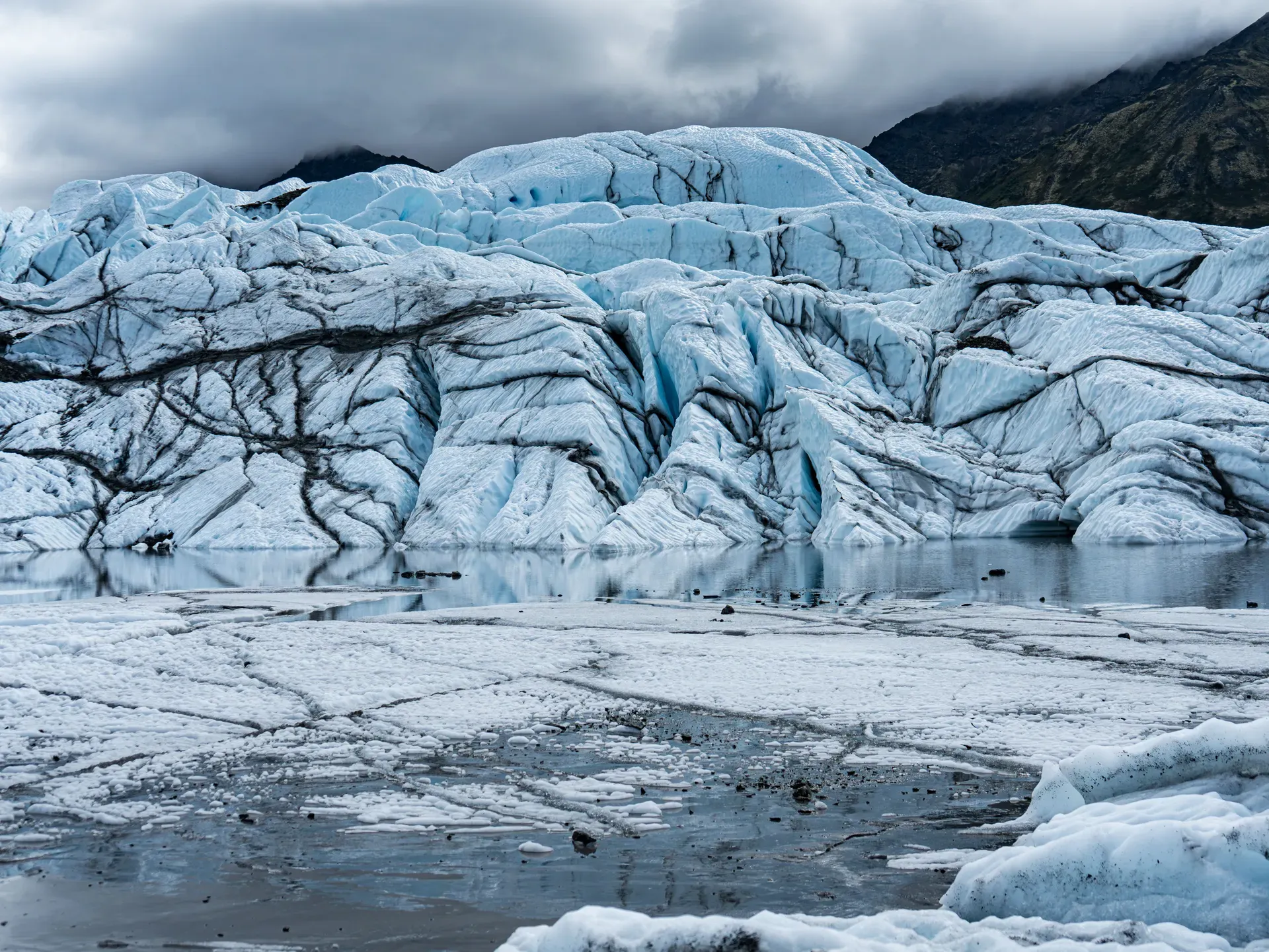
Matanuska Glacier is a 27-mile-long river of ice in Alaska's Chugach Mountains, located 100 miles northeast of Anchorage. It is the largest glacier in the United States accessible by car.
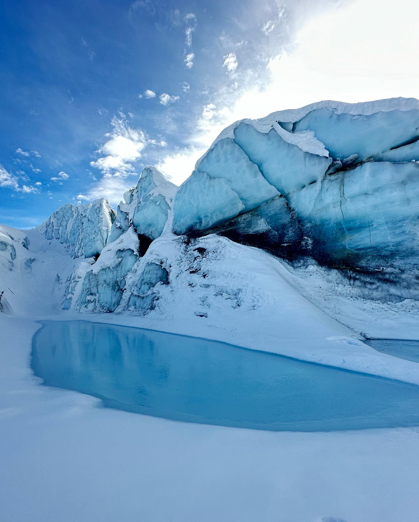
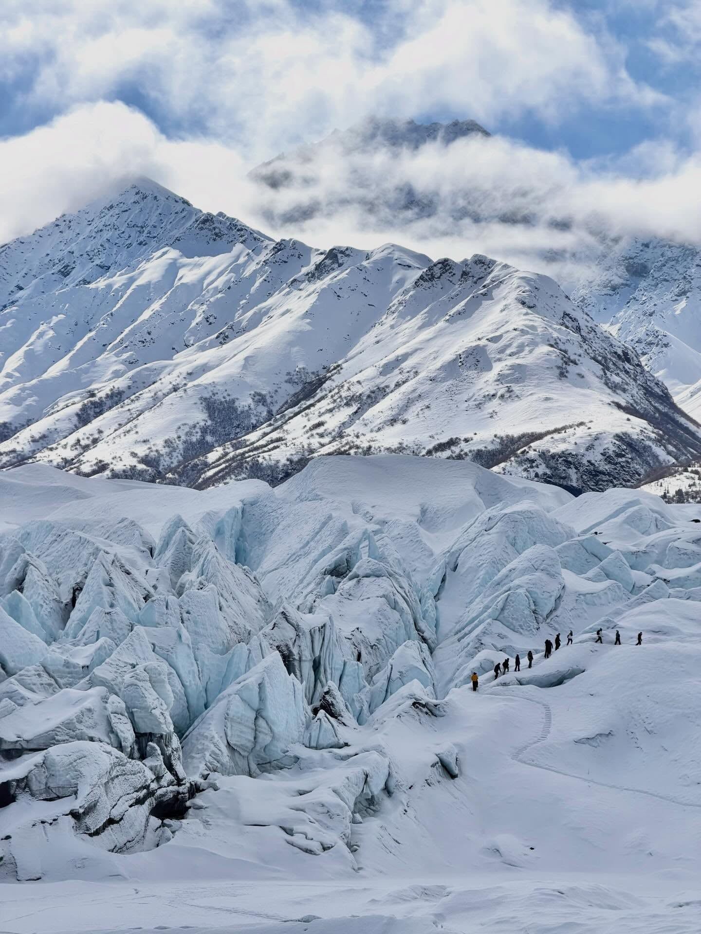
Matanuska Glacier flows 27 miles down a U-shaped valley in the Chugach Mountains, ending just off the Glenn Highway. It is the largest glacier in the United States you can reach by car. The ice stretches four miles wide at its terminus near mile marker 102. Visitors drive two hours northeast from Anchorage, park on a gravel moraine, and walk directly onto a 300-foot-thick sheet of ancient ice. The glacier advances about one foot per day. Meltwater cuts through the compacted snow and firn, forming vertical drainage shafts called moulins. When these shafts freeze at the bottom, they fill with water to create deep, turquoise blue pools. The surface is a maze of crevasses and towering ice blocks known as seracs. Ice climbers scale the smooth headwalls near the guided trekking routes on almost any summer day.
Drive north from Anchorage on the Glenn Highway, passing through Palmer and Chickaloon. The road winds through the Chugach foothills. Stop at the King Mountain viewpoint near mile marker 76 for a photo of the conical peak framed by the braided river. The blue "Glacier Park Glacier Access" sign at Mile 102 marks the turnoff. The private dirt road descends sharply to the glacier office. You must sign a liability waiver before proceeding.
Access is complicated. The land is split between public and private control. The Matanuska Glacier State Recreation Site at Mile 101 offers a 229-acre public space with a $7 forested viewing trail. You can camp at one of the 12 gravel-loop sites and wake up to direct glacier views. The 20-minute Edge Nature Trail leads to dedicated viewing platforms equipped with spotting scopes. But you can't touch the ice from the state park.
The only road to the actual glacier surface sits at Mile 102. A private operator controls this gate. They charge a $55 adult access fee (as of 2026), and state or national park passes don't apply. Teens cost $25, while children aged 8 to 12 enter free. Pay the fee online before you drive out. Once through the gate, a dirt road winds down to a parking lot right at the ice edge. Guides often let visitors scrape back the surface gravel to reveal solid blue ice just inches beneath their boots. A quick roadside stop takes 30 minutes, but a proper trek requires three hours.
During the Last Glacial Maximum 21,000 years ago, Matanuska Glacier merged with the neighboring Knik Glacier. The combined ice sheet pushed 50 miles west into the Anchorage Lowland. It deposited the Elmendorf Moraine, a massive ridge of gravel and rock that still defines the geography of modern Anchorage. Between 16,800 and 16,400 years ago, the ice retreated in a major melt phase. This retreat carved the deep, wide valley that the Matanuska River and the Glenn Highway occupy today. The U-shaped valley walls show the exact height of the ancient ice.
Unlike most Alaskan glaciers, Matanuska held a relatively stable terminus through the late 20th century. Studies show the ice edge barely moved between the 1970s and 2007. It is officially classified as retreating today, but it shrinks slower than other regional glaciers. The internal ice still pushes forward at a steady 30 centimeters daily. Gravity constantly pulls the mass down from the 13,176-foot Mount Marcus Baker.
The glacier's accessibility made it a popular roadside attraction as soon as the Glenn Highway was paved. Early tourists could simply pull over and walk to the ice. As liability concerns and land values rose, the informal access ended. The land surrounding the terminus changed hands. The state established the Matanuska Glacier State Recreation Site at Mile 101 for public viewing. But the physical access route over the moraine at Mile 102 fell under private control. An entity affiliated with Cook Inlet Region, Inc. manages this land.
This split ownership created a bottleneck. Visitors expecting public wilderness found a private toll gate. The arrangement generated headlines in the Washington Post and Anchorage Daily News as access fees climbed. Mandatory guide rules took effect for first-time or off-season visitors following safety incidents on the ice. In one fatal event, a snowmachine rider drove directly into a hidden crevasse. The transition to a strictly managed, fee-based entry system frustrated many locals. Alaska State Park passes and America the Beautiful passes lost their utility here.
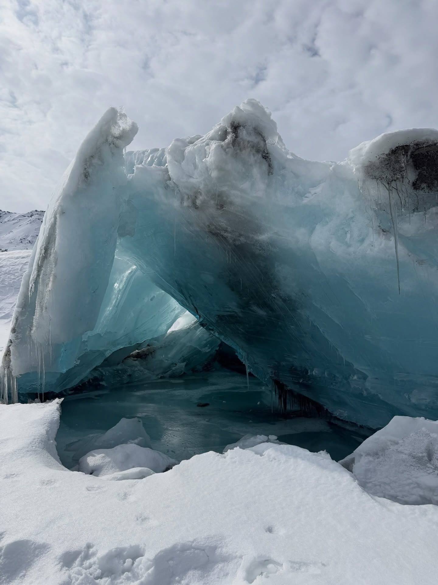
Today, the private gate operates year-round. Summer visitors can walk a marked unguided trail across the moraine. A sign reading "End of unguided trail. Do not proceed without proper footwear" marks the limit. Winter, spring, and fall access requires a certified guide. Don't visit in April or October. Rapid melting and refreezing make the trail unpredictable. Crevasses open to their widest just before the winter snowpack fills them in. Deep winter requires a guide, but the frozen lake beneath the headwall reveals unique blue ice cave formations that differ every year.
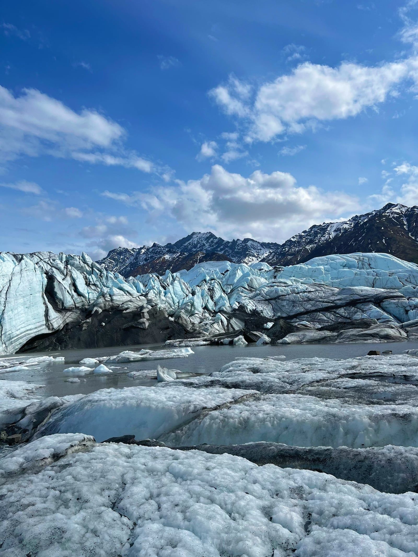
Matanuska is a valley glacier fed by an accumulation zone high in the Chugach Mountains. Gravity pulls the compacted snow and firn down the valley. The ice compresses into a dense, airless blue mass over decades. At the terminus, the glacier flares out into a four-mile-wide lobe ending in a proglacial lake. The ice here is roughly 300 feet thick.
The ice itself is composed of distinct layers. Snow falls in the accumulation zone, survives the summer melt, and becomes granular firn. Over decades, the weight of new snow compresses the firn into solid ice, squeezing out the air bubbles. This lack of air causes the ice to absorb red light and reflect blue light, giving the glacier its signature color. The blue appears most intense in overcast conditions or deep inside the ice caves that form in winter.
The surface is heavily fractured. As the ice moves over uneven bedrock, it splits into deep crevasses. Meltwater runs across the surface in summer and plunges into vertical shafts called moulins. One prominent blue pool regularly forms near coordinates 61.772882, -147.745979. Its exact depth and color shift every season based on the freeze-thaw cycle. Seracs—large, unstable columns of ice—tower over the lower sections. They frequently collapse without warning. Helicopter flightseeing tours from Sheep Mountain Lodge fly over the upper 25 miles of the glacier. This reveals massive crevasse fields and icefalls completely invisible from the terminus parking lot.
The ground leading to the ice is a terminal moraine. It consists of gravel, rocks, and glacial silt pushed forward by the glacier. This silt is a fine, powdery rock flour created when the glacier grinds against the valley walls. When wet, it acts like quicksand. A boot sunk an inch into wet silt creates a vacuum seal that is difficult to break. Stay on the cone-marked, grated path across the moraine flats.
Cold air rolls off the ice field constantly. These katabatic winds drop the temperature at the terminus well below the surrounding valley. Summer visitors often need insulated jackets while Palmer, 50 miles away, sits in short-sleeve weather. The wind accelerates as it funnels down the glacier's surface. Pack gloves and a windproof layer regardless of the August forecast. Rental microspikes only fit shoe sizes between US kids 2 and US mens 15. Bring your own traction gear if your feet fall outside that range.
The Matanuska River valley has long served as a travel corridor. Indigenous Ahtna and Dena'ina people traveled the region for trade and hunting. The glacier itself was a massive, shifting obstacle at the valley's head. Its meltwater feeds the Matanuska River, which sustains the downstream ecosystems and salmon runs central to local subsistence. The river flows out of the glacier's terminal lake and runs parallel to the Glenn Highway.
The glacier drives the local economy in the Mat-Su Borough. It supports a micro-economy of guide services, helicopter operators, and lodges. Companies like NOVA Alaska Guides and MICA Guides operate basecamps near the ice. The site brings thousands of tourists past the agricultural town of Palmer and into the remote Glacier View community. Visitors often combine a glacier trek with a whitewater rafting trip down the Matanuska River's "Lion's Head" run. Sheep Mountain Lodge, located 12 miles northeast, relies on glacier traffic to fill its cabins and seafood restaurant. The local community of Glacier View revolves entirely around the short summer tourist season.
The glacier is highly visible from the highway. Alaska Magazine listed it as the second best place to go in the state. It appears in countless travel itineraries for visitors combining Prince William Sound and interior Alaska road trips via the Richardson Highway junction at Glennallen. Guides require Wilderness First Aid certification and crevasse rescue training to lead groups beyond the unguided trail.
The glacier also acts as an accessible classroom for glaciology. Because researchers and students can drive heavy equipment directly to the terminus, it is one of the most studied ice masses in the state. Universities track its slow retreat and internal flow rate. For casual visitors, it provides a rare, low-barrier physical encounter with an active glacier. Families with young children and seniors up to age 75 regularly walk the ice on guided three-hour tours. The terrain involves roughly two miles of walking over uneven silt, gravel, and ice with a 285-foot elevation change. Book the 10:00 AM slot to avoid the heaviest afternoon winds.
Matanuska is the largest glacier in the United States accessible by car.
The internal ice moves forward about one foot per day, even as the terminus slowly melts back.
Meltwater shafts called moulins frequently freeze at the bottom and fill to form bright turquoise pools.
The glacier's source is Mount Marcus Baker, the highest peak in the Chugach Mountains at 13,176 feet.
Cold air blows continuously off the ice field, making the glacier significantly colder than the nearby highway.
Rock flour at the terminus turns into a quicksand-like mud that can trap a hiker's boot like a vacuum seal.
Helicopter tours fly over the upper 25 miles of the glacier, which are completely invisible from the parking lot.
Yes, self-guided access is permitted in summer at the private Mile 102 gate. You must pay the access fee, sign a waiver, and stay on the marked unguided trail. Winter, spring, and fall visits require a certified guide.
Viewing from the state recreation site at Mile 101 costs $7 per vehicle. Walking on the ice requires entering the private gate at Mile 102, which charges $55 per adult (2026 rates). Guided tours cost an additional $100 to $249 per person.
The glacier access gate is 102 miles northeast of Anchorage along the Glenn Highway. The drive takes roughly two to two and a half hours each way.
The glacier has real hazards, including hidden crevasses and quicksand-like glacial silt. Fatalities have occurred, including a snowmachine rider who fell into a crevasse. It is safe if you stay on marked trails or travel with a trained guide.
The glacier is 27 miles long and four miles wide at its terminus. It is a valley glacier flowing from the Chugach Mountains.
Wear sturdy waterproof boots that can fit rental microspikes. Bring warm layered clothing, gloves, and a windproof jacket to handle the cold katabatic winds blowing off the ice.
Yes, several operators run family tours paced for children as young as eight. These tours cover about two miles over three hours. Children must be supervised due to crevasse and silt hazards.
NOVA Alaska Guides enforces a strict no-drone policy within their permitted tour area. The surrounding land is state-owned, so recreational flights may be allowed elsewhere under FAA rules, but you must confirm with the specific landowner before launching.
June through August offers the most stable ice for walking and up to 19 hours of daylight. All guided tour companies operate fully during this window.
The only road leading to the actual ice crosses privately controlled land. The private operator charges their own gate fee, which is entirely separate from state or federal park systems.
Browse verified tours with free cancellation and instant confirmation.
Find Tours